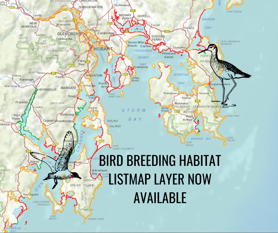
The Tasmanian Smart Seafood Partnership is pleased to announce that the ‘Bird breeding habitat and access recommendations’ state-wide layer in LISTmap is now live.
This LISTmap layer provides advice for coastal activities such as clean up events, weeding or field days, and can be used by the seafood industry, community groups and individuals. It uses a traffic light coding system to identify nesting shorebird and tern areas during the bird breeding season (1 September to 31 March). Recommendations relating to risk are;
Red = avoid human-related disturbance,
Orange = minimise human-related disturbance, and
Green = no current access constraints.
The layer includes breeding/nesting sites for six species: the Hooded Plover, Red-capped Plover, Australian Pied Oystercatcher, Sooty Oystercatcher, Fairy Tern and Little Tern and can be viewed at this link. An infosheet about the LISTmap layer will be available soon
The development of this layer has been a collaborative effort between NRE Tasmania, BirdLife Tasmania, NRM South and the Tasmanian Seafood Industry Council (through the Tasmanian Smart Seafood Partnership project) and the Tasmanian Oyster Company. This project is supported by NRM South and the Tasmanian Seafood Industry Council, through funding from the Australian Government’s National Landcare Program.