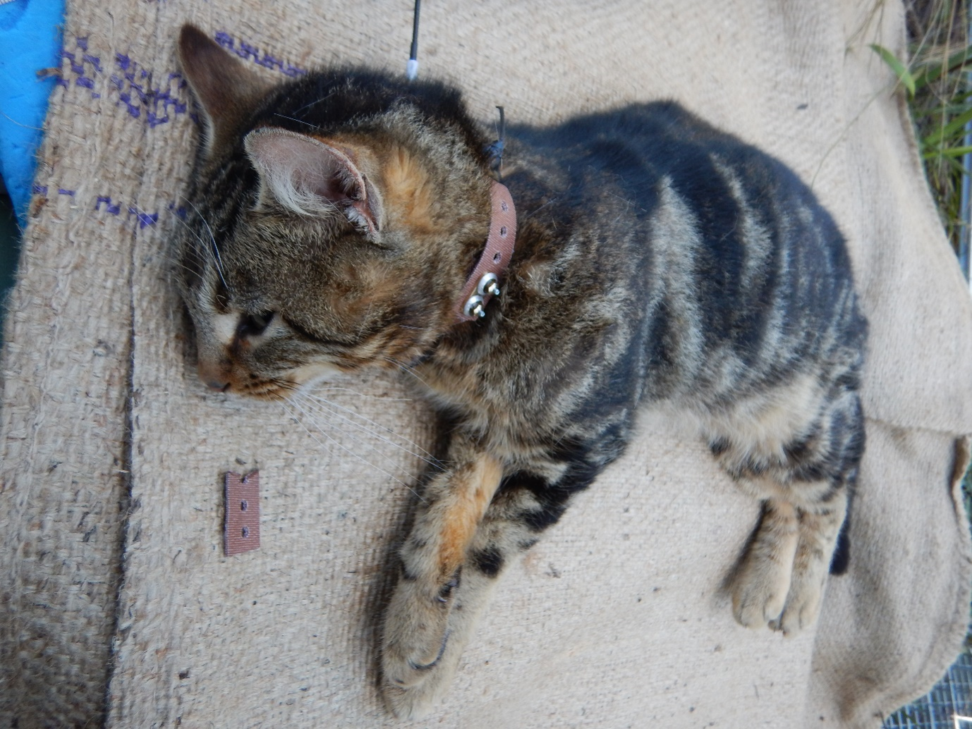
Letting the cat out of the bag is something most people try and avoid but Matt Pauza, a wildlife biologist for Biosecurity Tasmania, is quite literally tasked with doing this on a regular basis. Out on one of his regular visits to Bruny Island, Matt gently lowers a bag to the ground as he prepares to release a feral cat from its confines. Recently trapped on Bruny Island and fitted with a GPS collar before its release, this cat’s movement will be tracked over the coming months in the hopes of finding out more about its habits. After taking a second to gets its bearings, the cat springs away and disappears into the thick coastal heathland.
Matt is undertaking crucial research into the ecology of feral cats on Bruny Island, providing vital information for NRM South’s Australian Government-funded project to protect eastern quolls and manage the island’s cat population. The cats that Matt is collaring and tracking are all feral cats – cats that permanently live in the wild, removed from humans. However, domestic, stray and feral cats all have significant impacts on Bruny Island’s unique and diverse wildlife – including eastern quolls. As well as directly predating on native species, cats are also commonly host to two parasites, toxoplasmosis and sarcocystis, that cause significant issues for sheep farmers and native mammals.
Cat management is an effective means of both protecting wildlife and supporting agriculture, and feral cat control has been underway on Bruny Island since 2017. The current round of the project (which has been running since 2020) has removed more than 90 cats from the project area in the last 18 months. Despite this progress, knowledge of cat movements on Bruny Island is limited, and this has ongoing implications for their management.
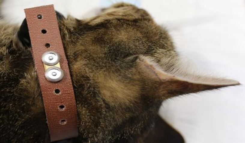
Matt began GPS collaring feral cats on Bruny in 2018 as, at the time, there wasn’t much information available about their range, habitat preferences or how they move through the landscape (for example, whether they move preferentially along habitat features such as beaches or forest edges). This type of information is critical to the success of the trapping program as it helps inform when and where to target management actions to ensure the best results.
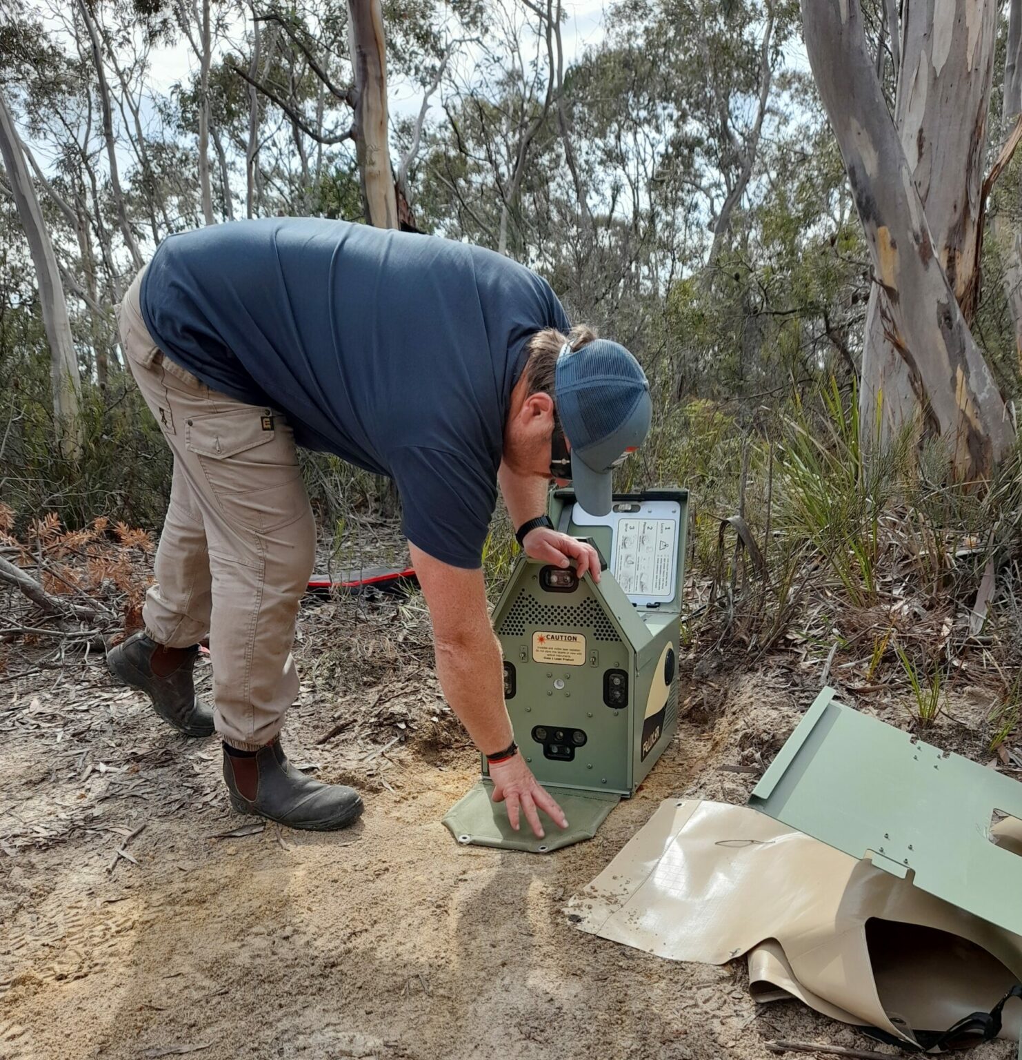
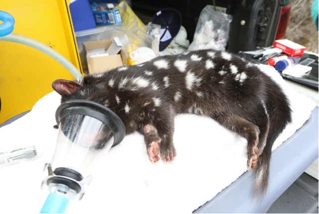
Catching and deploying GPS collars on feral cats is tricky. A deft hand and adept trapping skills are needed to handle these often large and wily animals, sedate them and fit the GPS collars. Two feral cats have now been collared as part of the current project, and the data collected so far is building on movement data collected in 2018 and 2019 to provide a better picture of how feral cats move and survive on the island at different times of year.
‘Most of the cats I have collared to date have been observed using the shearwater colonies in the southern portion of north Bruny Island. The cats appear to use this area throughout the year. However, once the shearwaters leave in April on their northern migration, the cats expand their home range to include the forest, rural and coastal landscapes adjacent to the colonies. Conversely when the shearwaters return to breed in September, the cats focus and reduce their movements to colonies. We can use this habitual movement to better target and control feral cats.’ – Matt Pauza
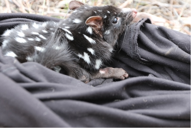
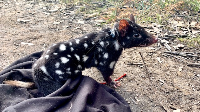
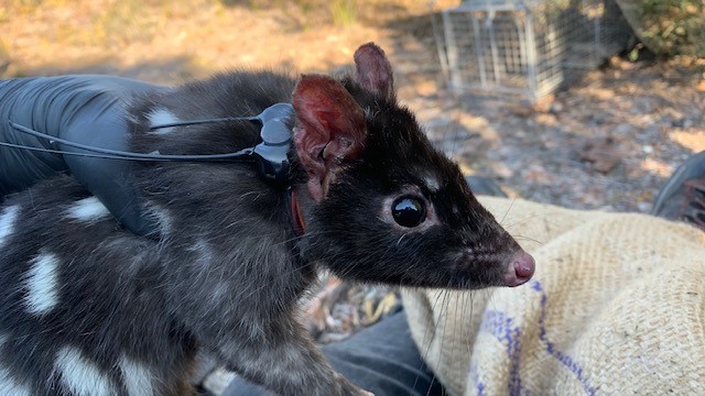
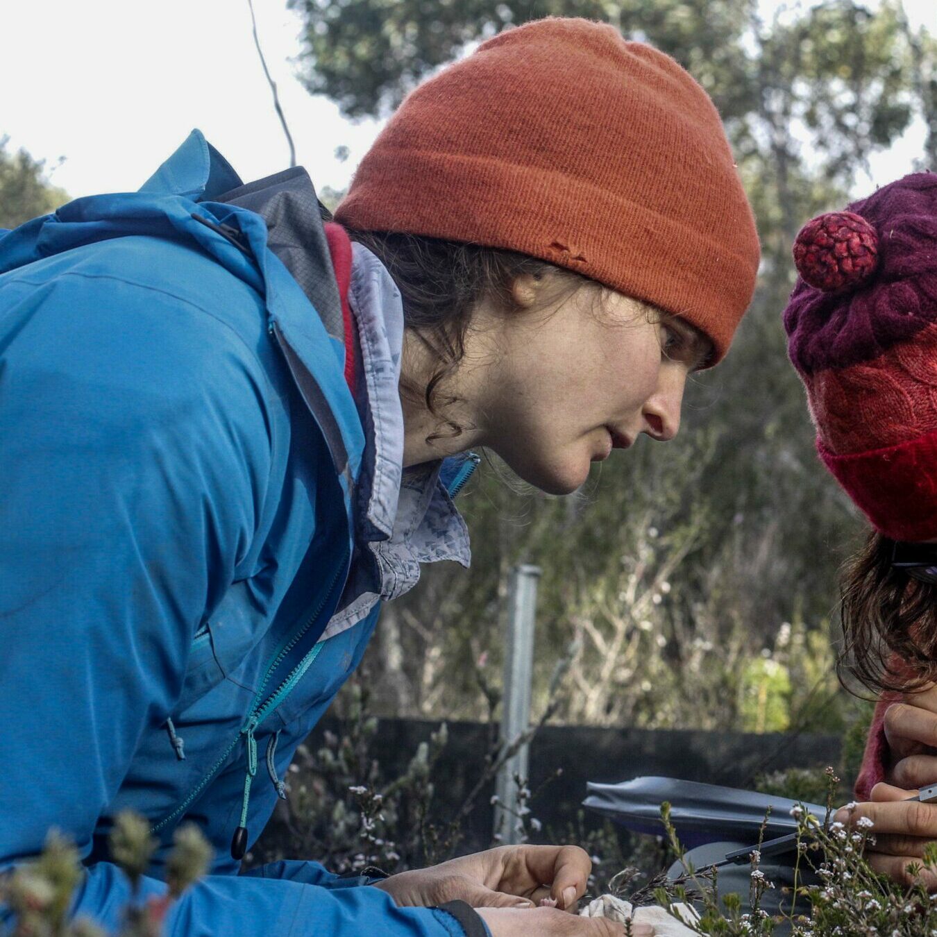
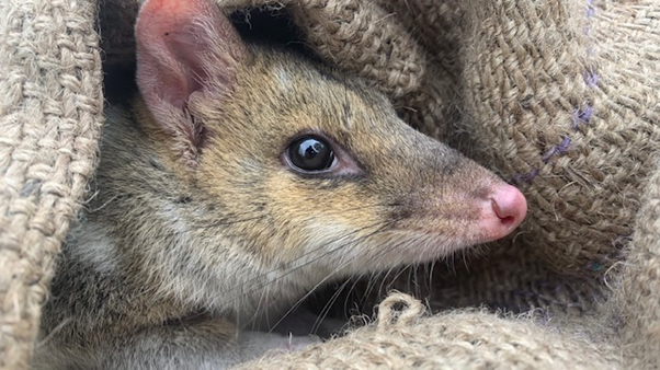
In addition to examining the movement ecology of feral cats, Matt is also getting a better idea of the extent feral cats interact with the endangered eastern quoll. Matt has been collaring quolls around the Neck and Cape Queen Elizabeth to investigate how they interact with feral cats, and how they might use habitat differently to avoid cats.
‘Attaching GPS collars to quolls has required some attention to detail. After seeking advice from mainland researchers working on similar sized species, I have been able to perfect my methods and I am now waiting for the data to come in from the collars I have deployed. Bruny is something of a stronghold for eastern quolls and this data will give us good insight into how this species interacts with feral cats and provide information on the threat they may pose to quolls on the island.’ – Matt Pauza
Rosie Hohnen, Senior Project Officer overseeing the project for NRM South, has relied heavily on Matt’s data to inform the feral cat trapping activities on the island and has been able to get a better understanding of where, and how far, feral cats can travel.
‘Seeing the data from Matt’s work has been a real eye opener in terms of understanding the impacts of cats on Bruny. Some cats have moved huge distances in a single night and have been recorded in parts of the island we didn’t realise they visited. We’re hoping that the more data we collect the better picture we can build of their habitat preferences, and areas we should target that will make our program more effective and have better results for Bruny’s wildlife and farmers.’– Rosie Hohnen.
Heading towards the end of the project’s second year, additional animals will be collared as part of this research. During the final year of the project, the data collected from both feral cats and quolls will be collected and analysed. This data will feed into a report on feral cat and eastern quoll ecology and interactions on Bruny Island.
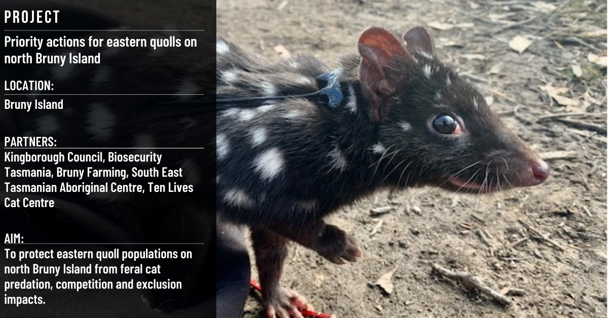
This project is supported by NRM South through funding from the Australian Government. It is a partnership project with Kingborough Council, Biosecurity Tasmania, Bruny Farming, the South East Tasmanian Aboriginal Centre and the Ten Lives Cat Centre and supported by weetapoona Aboriginal Corporation.